To help with your exploring of distance bike rides, Kyler Blodgett put together a list of some middle-to-long-distance routes with a few technical details and tips he wish he’d known before embarking. Remember that during COVID-related park closures, access to these trails could change.
This is a guest blog post written by a member of the New Orleans biking community, Kyler Blodgett. All of the information here is from Kyler’s experience and perspective. These routes may also have changes and Bike Easy can not take responsibility for the accuracy of every detail in this blog post
In the time of COVID-19, many recreational bikers might have a desire to explore routes further afield but aren’t certain where to start. I’m one of you. I’m a casual biker – riding the Greenway with my bungee-corded milk crate – but have been fortunate enough to spend more time on my bike in recent weeks. I even set the outlandish goal of biking from New Orleans to Baton Rouge in a single day before the summer, several times the distance of any of my pre-2020 rides.
This window for adventure raised the question of where to find pleasant paved places to ride long distances. A quick internet scan about New Orleans biking wasn’t much help; most articles suggested leisurely rides through the French Quarter or City Park, preferably with beverage in hand. Bike Easy publishes a great map of Orleans Parish routes, but I wanted to push the edges of the map as my rides climbed from 20 to 30 then to 40 miles and beyond.
To help with your exploring, I put together a list of some of my middle-to-long-distance routes from this spring with a few technical details and tips I wish I’d known before embarking. Remember that during COVID-related park closures, access to these trails could change.
Throughout this adventure, I couldn’t help but notice that often wealthier and whiter neighborhoods had safe, well-maintained trails and lower-income communities of color did not. I hope that this resource doesn’t just help you find more biking trails but also illuminates the need for us to keep pushing for investments in safe recreational options for all area residents, a realization I certainly experienced trying out these different trails.
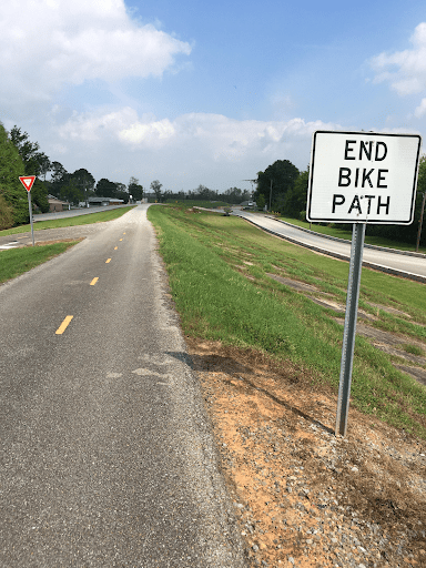
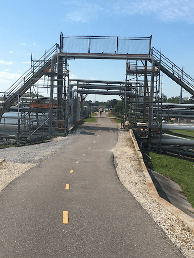
Eastbank Mississippi River Levee Trail (36 miles, protected bike lane with some interruption)
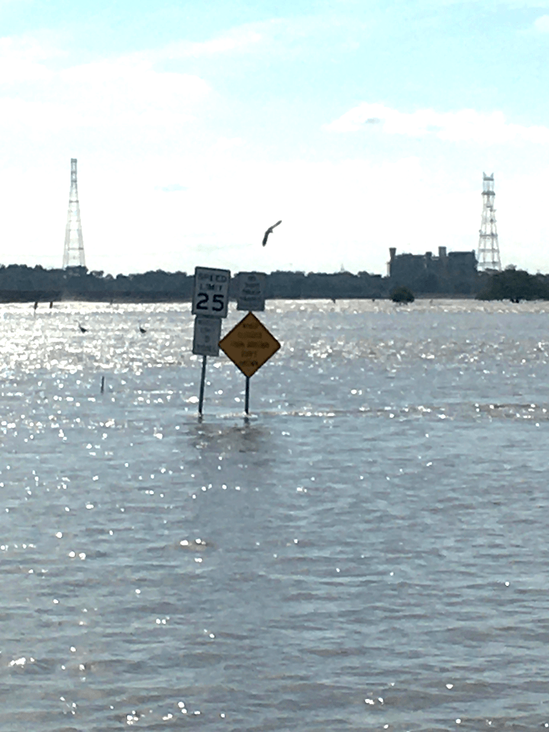
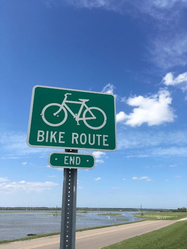
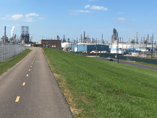
Arguably the most popular long-distance one for local bikers, this paved trail runs from Uptown to Reserve, LA. Starting at The Fly Riverview Park, the well-maintained path lasts 27 miles until just past Norco, where you meet the Bonnet Carré Spillway. Don’t be fooled by Google Maps which suggests that River Road easily bypasses the Spillway – as of April 2020 the road was covered by 4 feet of water and, according to a park ranger I asked while gazing out over the wet expanse, has been that way for 2 years. You have to work your way 1.5 miles up to Airline Hwy to bypass this.
On the other side of the Spillway the levee trail continues as gravel for about 6 miles until you leave St. Charles Parish. It’s then paved until the trail ends rather unceremoniously in Reserve, 36 miles from the New Orleans trailhead. Audubon Trailhead Parking here, Reserve parking here at Our Lady of Grace Church.
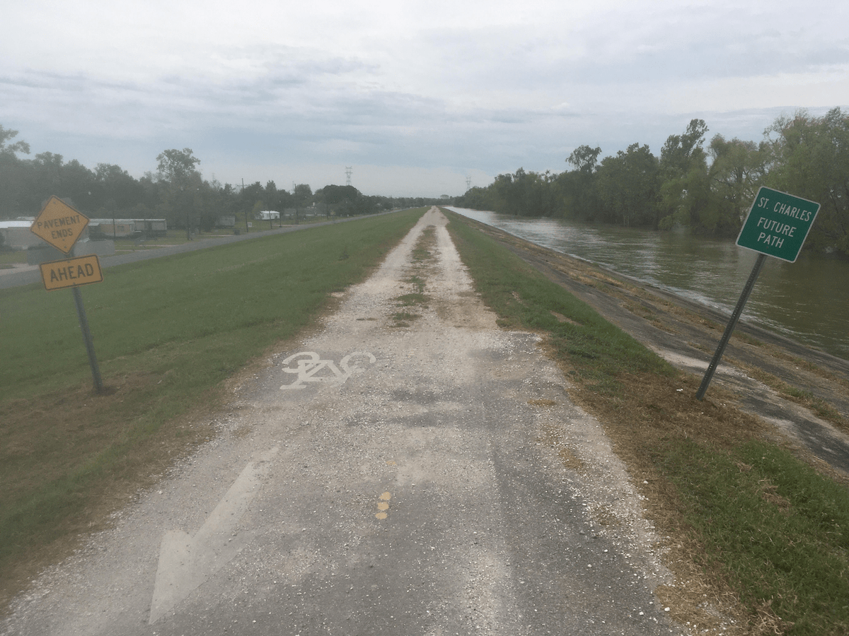
Westbank Mississippi River Levee Trail (33.5 miles, protected bike lane with some interruption)
A beautiful under-appreciated cousin of the popular Eastbank trail, this trail stretches from Algiers to Hahnville. Starting from Algiers Point, the paved path only lasts for 3.5 miles before dropping you unexpectedly by the Parish Courthouse. But don’t despair, you can follow the industrial and moderately-trafficked 4th St to River Rd for about 5 miles until you hop back on a paved levee bike path in Westwego. At that point you have a fairly peaceful 25 miles out to Hahnville, the trail’s western terminus.
The only interruption is long-term construction blocking the trail just after Bridge City. Follow River Rd west for 2 miles until the paved levee trail begins again. Alligators, bald eagles, and copious ducks flocking for seeds falling from the massive grain elevators adjacent to the path are all part of the natural beauty surrounding this trail. Trailheads at Algiers Ferry Terminal with parking and near the Hahnville Economy Supermarket.
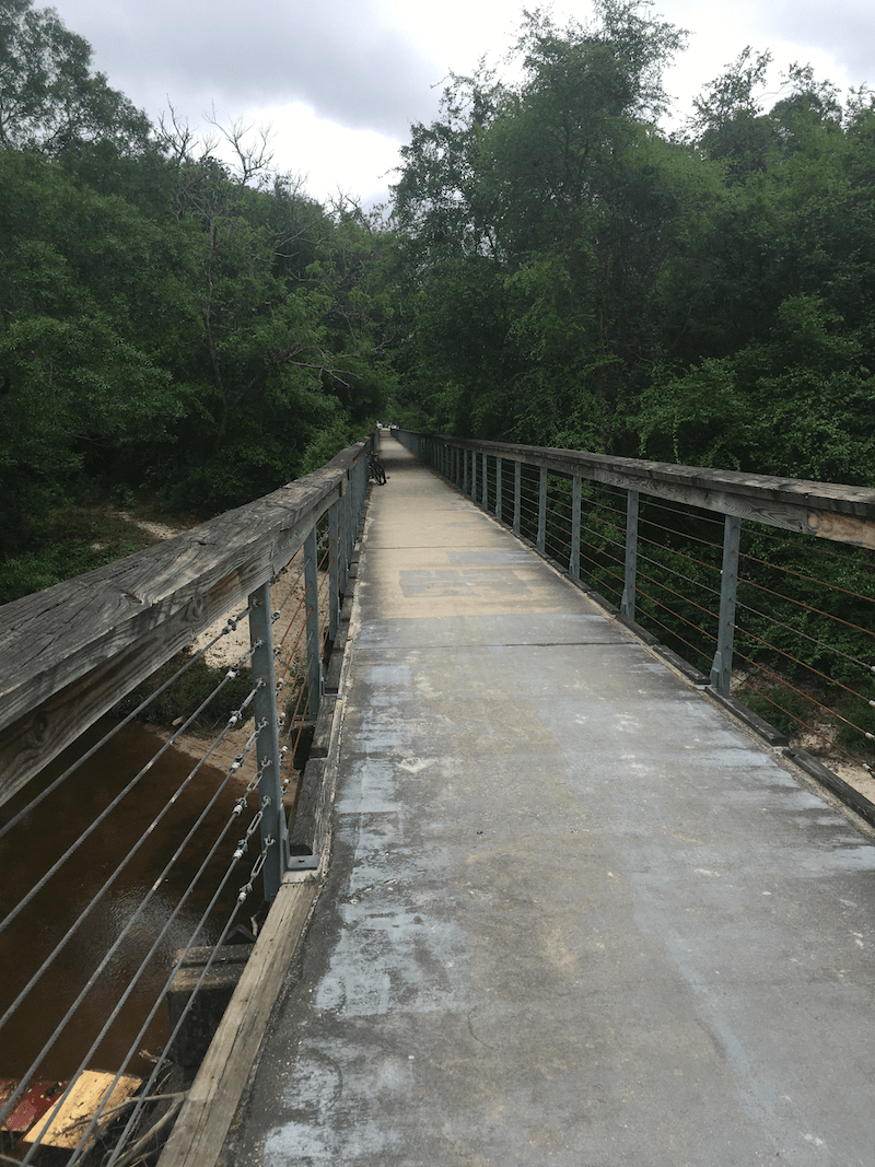
St. Tammany Trace (27 miles, separated bike path)
By far the most pleasant trail I have had the privilege to sweat on, this paved path connects western Slidell to downtown Covington. Wonderfully shaded and passing through backyards, Fontainebleau State Park, and fun small towns like Abita Springs (which might have the coolest trail-side inclusive playground for kids in the world), this trail is a biker’s joy. It can even be forgiven for ending oddly at a somewhat hidden and rather unlikely statue of Ronald Reagan in Covington.
The Slidell trailhead has convenient parking just off Gause Blvd., and the Covington one ends a stone’s throw from the St. Tammany Parish Justice Center with ample parking.
Lakefront Levee Trail (18 miles, mix of protected trails and street-level paths)
The best of this Lakefront biking runs from the Leon C Simon bridge to Duncan Canal in Kenner. As a mid-city resident, I often pedal my way up Robert E. Lee Blvd. and across the 17th St Canal, hopping on the levee trail from there. From this point the trail yawns out to the west, dipping under the Causeway and passing the Treasure Chest Casino but precious little else in the 10 miles before it hits Duncan Canal in western Kenner. Follow the canal south for 2.5 miles before you meet a series of “Parish Property: No Trespassing” signs warning that it’s time to turn around.
The Kenner trailhead is at the southern tip of Grand Lake Blvd. on Duncan Canal, and plenty of parking along Lakeshore Dr. near the Leon C Simon bridge as the eastern terminus.
St. Claude Ave. (15 miles from Canal St. to Poydras, LA, designated bike lane and shoulder)
For my circumstance this is a nice out-and-back for a 20 mile ride to Paris Blvd with an extension for adventurous riders seeking a longer route. My curiosity had been piqued by the bike lane that starts downtown on N Rampart St., becoming St. Claude Ave. How far did extend? Would it lead to new biking adventures southeast of the city whereas most well-known routes are west and north?
The lane gets bumpy as it crosses the Industrial Canal and over various train tracks in the Arabi, but overall makes for an enjoyable ride which includes Chalmette Battlefield. The bike lane ends at Paris Blvd., 8 miles from Canal St. downtown. Continuing straight onto E St. Bernard Highway leads to green pastures (literally) and the town of Poydras, pleasant despite the occasional narrow shoulder.
Chef Menteur Highway & the East (various routes, mostly on the shoulder)
The East has less biking infrastructure than most of the city, so please be careful. With so much land, access to nature, and over 100,000 residents, it’s a shame the city hasn’t invested in more biking and walking infrastructure here. Still, if you can catch it on a quiet day (and we all know there’s less traffic on the roads right now), Chef Menteur Highway heading east is a beautiful spot for a ride, especially once you pass the split with Route 11. Don’t let the name “Highway” scare you off; there’s a wide, smooth, uncluttered shoulder and only the occasional car. This road goes all the way into Mississippi and beyond with beautiful wildlife, stilt houses with clever names like “Someday Came”, and bayou views to make it worth your while.
If you’re looking for a shorter ride closer to downtown, there’s also a concrete levee path for bikers and pedestrians that hugs the lakefront side of Hayne Blvd., proceeding mostly uninterrupted from just past the lakefront airport to Paris Blvd., approximately 5 miles. If you want to extend this, don’t count on Google Maps; the apparent road that continues on the levee past Paris Blvd. is a patchily cobbled cinder blocker surface that proves totally unbikeable.
If you don’t live in the East, your ticket out there is the Leon C Simon Bridge with a narrow sidewalk to walk your bike, which you can access from the biker-friendly Lakeshore Dr.
If you’re biking Chef Highway, there are good parking options at Dong Phuong Bakery (and what better post-ride treat could you ask for?) and Bayou Sauvage Ride Trail and Boardwalk 2 miles further east.
***
These trips have opened my eyes to the encouraging investments people have already made for the health of their communities, and the great deal more to be done to make sure that all neighborhoods – high- and low-income, urban and rural – have close access to safe outdoor recreational options. As you add your own routes to this list, I hope you’ll take the extra step of advocating for all of our city’s walkers, runners, and bikers. This infrastructure isn’t just about recreational bikers like me. Bike Easy, as a member of the New Orleans Complete Streets Coalition, recognizes the health, personal safety, environmental, and economic benefits of investing in better equitable transit for everyone using the road. This is for all of us. See you out there.